Remote sensing of ancient Maya land use features at Caracol, Belize related to tropical rainforest structure (PI – Weishampel)
Caracol is one of the largest Maya archaeological sites in Mesoamerica. During its heyday (ca. AD 650), it was among the most populous cities in the Pre-Columbian world. To understand the social, political, economic, and ecological implications of historic settlement/land use patterns requires broad-scale, regional surveys that extend beyond the urban epicenter. To accomplish this, we are using:
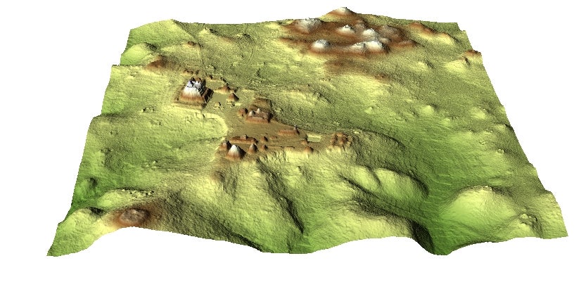
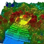
(1) Satellite remote sensing to detect Maya archaeological features at Caracol based on spectral signatures of the rainforest vegetation; and (2) Airborne LiDAR to map below-canopy terrain encompassing known and newly satellite detected features. Through these two objectives, the spatial extent (~180 km2) and distribution of structures comprising urban and suburban settlements are being revealed. The results from the passive, remote sen sing (Landsat TM and hyperspatial) helped dictate the flight coverage of the smallfootprint, canopy-penetrating LiDAR. From this active, fine-resolution sensor, many new features, e.g., causeways, agricultural terraces, reservoirs, irrigation canals, plazas, and buildings around Caracol, have been identified, digitized, and analyzed at a regional scale. At present, less than one-fifth of this extensive site has been ground surveyed. This study represents the most ambitious application of LiDAR for archaeological prospecting to date.
Although the Maya typically cleared >75% of their landscape for agriculture and settlements, the rainforests rebounded to yield the most recent, vast natural reforestation event. Through combining archaeological,

ecological, and remote sensing expertise using the data acquired from (1) and (2) and we have been able to relate contemporary rainforest canopy structure to historic Maya land use regimes. From the hyperspatial satellite imagery and airborne LiDAR data, we derived aboveground biomass and habitat structure measures (i.e., canopy top height, vertical distribution of return, degree of canopy openness, crown diameter of dominant trees, canopy texture) for the landscape around Caracol. Thus, we assessed forest recovery patterns in relation to a variety of land use legacies.
Investigation of the effects of sea level rise on sea turtle, shorebird, seabird, and beach mouse nesting distributions within the South Atlantic Landscape Conservation Cooperative region (PI – Von Holle)
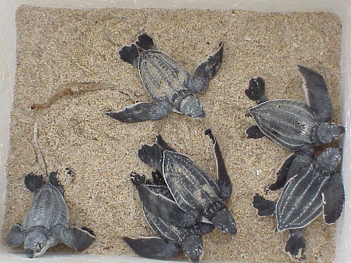
Sea level rise (SLR) and disturbances from increased storm activity are expected to diminish coastal habitats available for sea turtle, seabird, shorebird, and beach mouse nesting by removing habitat as well as inundating nests during critical incubation periods. The goal of our proposed research is to evaluate past nesting patterns of fourteen coastal nesting species and predict future effects of sea level rise on nesting beaches along the South Atlantic Bight. Maps of coastal vulnerability to SLR combined with historical data sets of long-term and spatially extensive nesting habitat will lead to models that enhance our understanding of the complex environmental changes occurring from global climate change and their effects on globally imperiled species. The results from this study will equip policy makers and natural area managers with the ability to prioritize those areas which will need the greatest conservation intervention.
 The coastal study areas include nesting beaches for fourteen species from North Carolina south to Melbourne, Florida. Our study will link long-term survey data for four species of sea turtle, three species of shorebird, five species of seabird, and two beach mouse species to maps of coastal vulnerability to sea level rise (SLR) in order to understand the effects of sea level rise on population viability and socioeconomic effects. First, we will create habitat suitability maps for coastal nesting species along the South Atlantic Bight. Second, we will integrate a model of SLR along with long term field biological observations in order to predict vulnerability to nesting habitat loss for sea turtle, seabird and shorebird, and beach mouse species within our study region. Third, habitat loss vulnerability maps under different predictions of SLR, considering local SLR and eustatic SLR induced by climate change, will allow natural area managers to construct strategies for mitigating the impacts of a changing climate on these coastal nesting species, many of which are threatened and endangered. Fourth, we will estimate the socioeconomic costs of changes in coastal nesting habitats and the benefits of implementing different mitigation strategies for our study region. Last, we will estimate future populations of these species with SLR, given survivorship under different development scenarios.
With the results from our study, planners and decision makers will be able to choose from a portfolio of mitigation techniques for policies relevant to coastal nesting species. There is an urgent need to determine long-
term plans so that the most cost-effective strategies of reducing the effects of sea level rise on coastal species can be determined.
see SALCC project videos: Sea Level Rise and Coastal Species and Interim Report
Remote Sensing of Nesting Sea Turtle Tracks: Development and Application of Computer Vision Algorithms (PI – Weishampel)
The interpretation of remotely sensed imagery is of paramount importance for the Earth and space sciences. Rich data streams from numerous airborne and satellite sensors representing multiple resolutions and multiple spectral bands have far exceeded our ability to extract comparable detailed information to provide environmental managers and policy makers with meaningful guidance. This project is designed to develop computer vision algorithms for a specific ecological application, i.e., to detect, segment, and distinguish different types of sea turtle tracks using imagery data provided by a remote controlled unmanned aerial vehicle (UAV) system. Though this study is focused on this particular scenario, the applications are much more wide reaching in terms of general pattern recognition, which are relevant to the Florida Space Institute (FSI) Space Research Initiative (SRI) for both inward (environmental – towards earth) and outward (astronomical – towards space) remote sensing.
