Landing Site
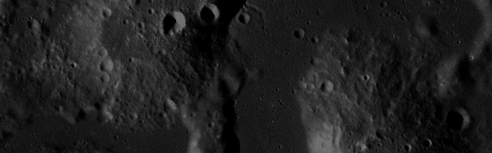
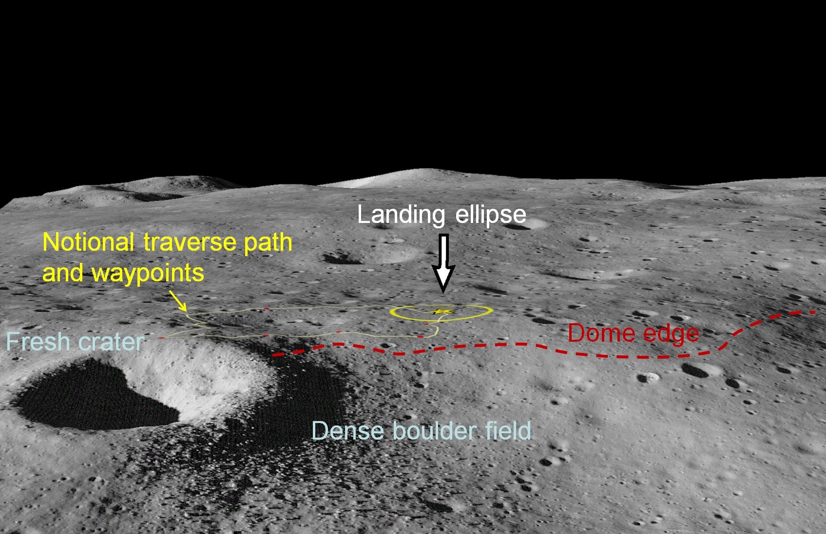
Selecting a landing site requires balancing science and exploration goals of the mission with the safety requirements for landing and rover trafficability. To achieve the Lunar-VISE science and exploration goals, we needed a landing site that had easy access to boulders and regolith. Geologists use boulders as probes to understand what types of rocks make up a geologic feature like a volcano – they can reveal information about the composition from different layers and histories of the feature. The Lunar-VISE team selected a location on Mons Gruithuisen Gamma (also known as Gamma Dome) near a 150 m diameter impact crater named Mareta. The impact event that formed Mareta crater ejected a large boulder field that we will use the rover to explore.
The landing site is far enough from Mareta crater to avoid the risk of accidentally landing inside but close enough to be able to take measurements of the rocks that were ejected from the crater at the time of impact.
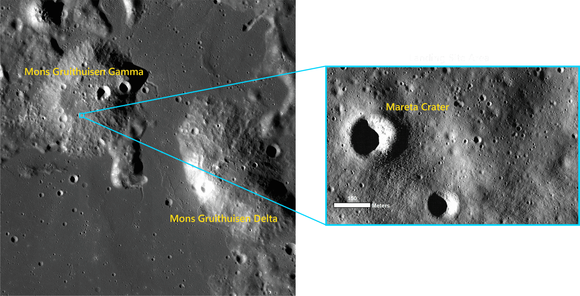
Image Credit: NASA/GSFC/ASU
“Circle” marks the spot!
To ensure the safety of the lander and rover, we selected a landing site (as marked by the blue circle in the figures below) that was: (1) relatively flat (< 5-degree slopes), (2) relatively boulder and crater free (as measured by a low terrain ruggedness index or TRI) and (3) well-lit throughout the lunar day. It was also important to make sure the rover and lander would have line-of-sight during surface operations for communications.
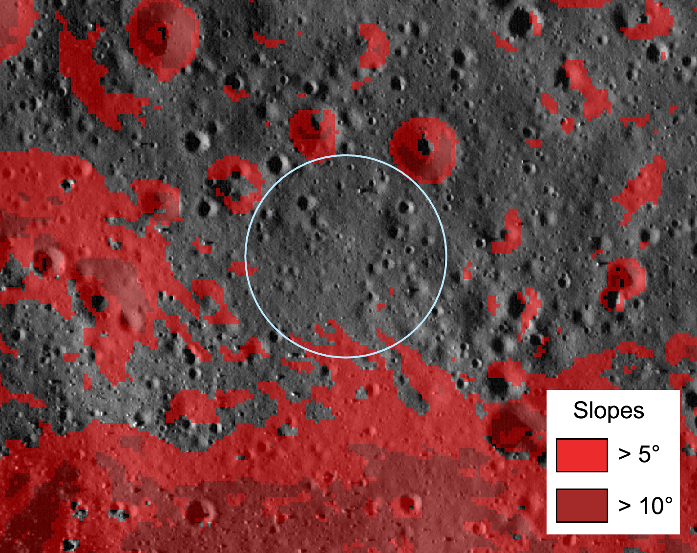
Map of surface slopes in the area around the landing ellipse
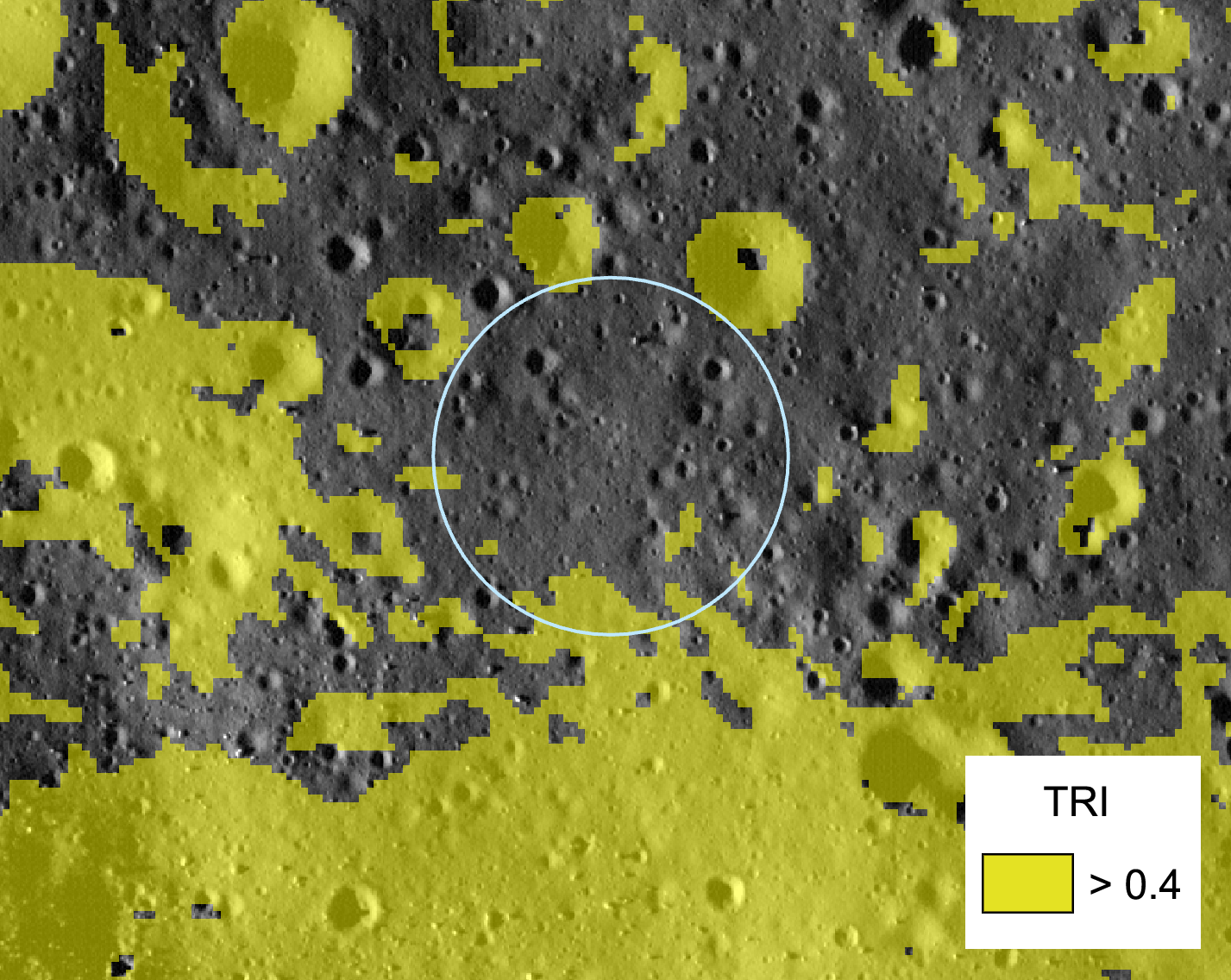
Map of rough areas (TRI) surrounding the landing ellipse
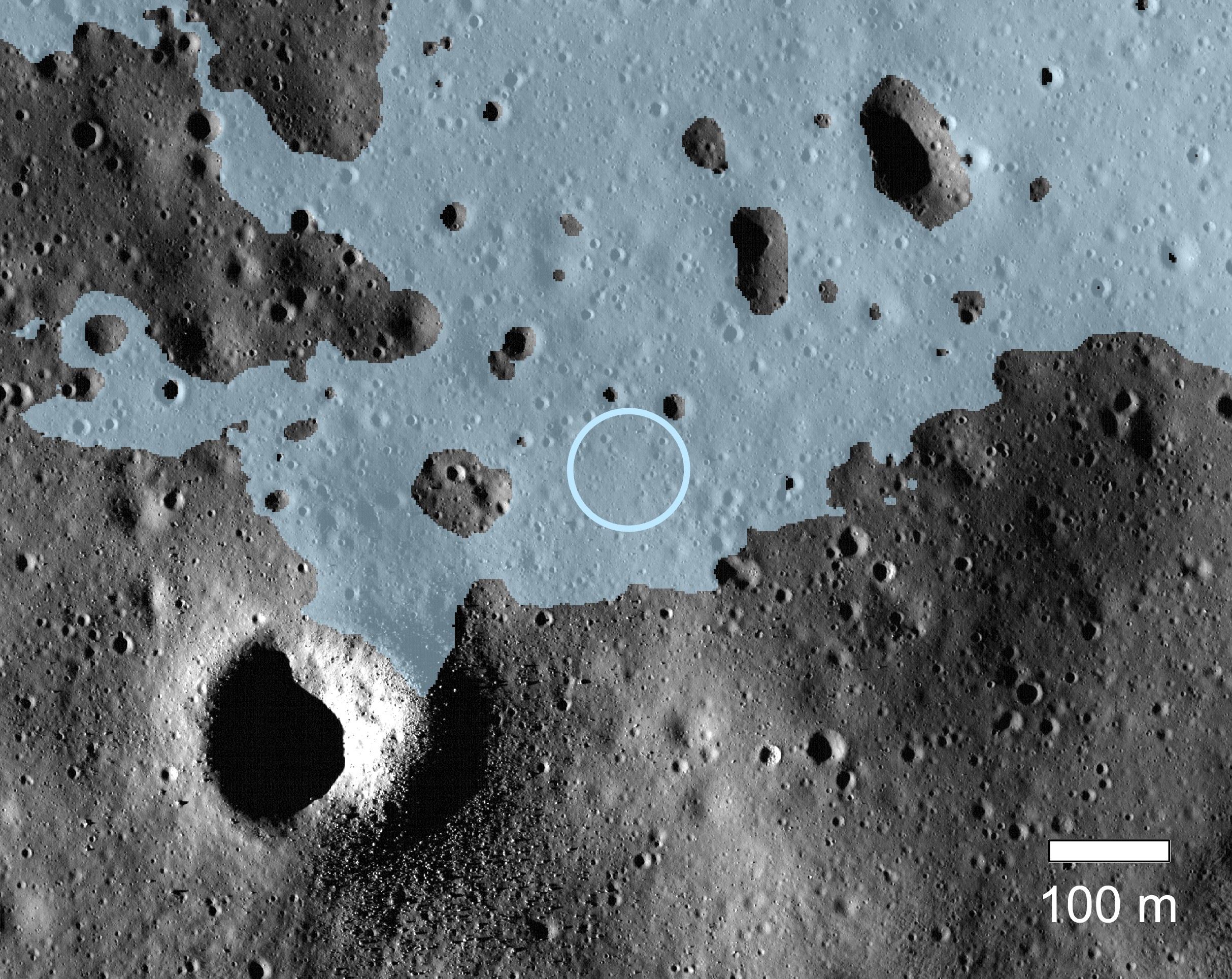
Areas where the rover can traverse while maintaining line-of-sight with the lander
Notional Rover Traverse
We selected locations around the landing site, also known as waypoints, for the rover to traverse and use the Lunar-VISE rover instruments to observe the regolith and boulders at that location. Our waypoints were selected to successfully accomplish our science and exploration goals, including going to a location that would allow us to see the maria (MAR-ee-uh), or basaltic plains, surrounding the Gamma Dome.
All image credits (unless otherwise marked): J. P. Williams et al 2024