National Geographic Educator of the Week

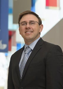
Tim Hawthorne headshot for GSURC
Timothy L. Hawthorne, Ph.D., assistant professor of geographic information systems (GIS) in the department of sociology, is featured as the National Geographic Educator of the Week. Dr. Hawthorne spent his summer teaching students at the Urban Atlanta Geospatial STEM Academy as part of a $75,000 Verizon Foundation grant. This academy provides a place for students to learn about geospatial technologies in a fun environment at no cost to their families. There are approximately 100 students involved in the academy, primarily from Title 1 high schools in Atlanta.
Geospatial technology refers to equipment used in visualization, measurement, and analysis of earth’s features, typically involving such systems as GPS (global positioning systems), GIS (geographical information systems), and RS (remote sensing).
Geospatial technology affects almost every aspect of life. It is used by surveyors to determine where a street or a business is going to be; by law enforcement to locate crimes; by emergency services for fire response or disaster management; to locate water resources; in public health to track the spread of disease, and many other ways.
Dr. Hawthorne recently relocated to Orlando, FL and joined the faculty in the department of sociology at UCF. He earned his PhD in Geography in 2010 from The Department of Geography at The Ohio State University where he worked under the direction of Dr. Mei-Po Kwan. He received his M.A. in Geography in 2005 from the Department of Geology and Geography at West Virginia University where he worked under the direction of Dr. Daniel Weiner. Dr. Hawthorne is also a 2003 graduate of Ohio Wesleyan University where he received a Bachelor of Arts degree majoring in Geography with a minor in English where he was advised by Dr. John Krygier.
Dr. Hawthorne is excited to join the new GIS cluster at UCF with Yingru Li, Ph.D., assistant professor in the department of sociology, and Scott Branting, Ph.D., assistant professor in the department of anthropology.
The GIS cluster provides a collaborative space to develop innovative methodologies, research projects, and activities that can utilize geographic information systems and related geospatial technologies, while cutting across multiple disciplines. The new cluster will challenge faculty and students to think more broadly about how GIS impacts society and how we can more effectively work across disciplinary boundaries.
Along with the other GIS cluster faculty, Dr. Hawthorne hopes to develop a new GIS certificate program at the graduate and undergraduate levels. Long-term, he would love to see UCF develop a Ph.D. program around interdisciplinary GIS applications.
Hawthorne plans to develop The Orlando Citizen Science GIS Center to provide research and education opportunities for the UCF community to work collaboratively on GIS projects that include community, industry, educational, and government partners throughout the region. He will also be continuing his work in Belize and plans to offer a new international GIS study abroad course in Belize beginning summer 2016, along with bringing a similar high school GIS program to Orlando with new funding from Verizon and other sources.
