
Critical Seagrass Mapping Project Continues Uninterrupted Thanks to Remote Instruction
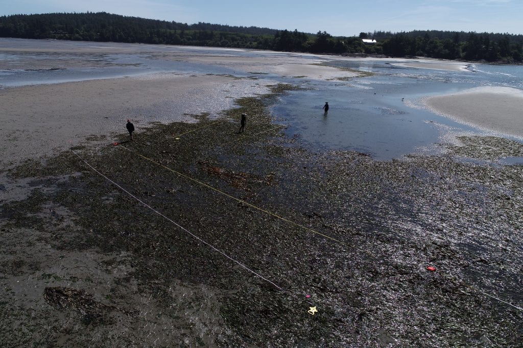
A drone capture of the Pacific West Coast. (Credit: Citizen Science GIS)
Critical work mapping seagrass beds on the Pacific West Coast continues uninterrupted this fall thanks to innovative thinking from the Citizen Science GIS team.
The seagrass (also known as eelgrass) project is funded by a $1.3 million grant from the National Science Foundation and helps researchers to measure seagrass meadow dynamics over time. This data will be used to analyze the health of habitats vital to the survival of ecology on the West Coast through a collaborative project with Smithsonian MarineGEO.
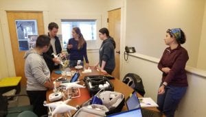
Drone training (Credit: Citizen Science GIS)
Drones play a key role in providing a literal bird-eye’s view of the growth and diminishment of the seagrass beds, but they require special licensing and training to fly. UCF’s drone experts planned to train their research affiliates first-hand as they did when the project first began in 2019, but the global shutdown threatened to halt the second year of the project just before the team began their second round of fieldwork in March.
Instead, Timothy Hawthorne, Ph.D, and Bo Yang, Ph.D, found a way to virtually bridge the gap between the East and West Coasts. The innovative online training program was successful enough for research affiliates from the University of Washington and Cornell to complete their FAA drone certification process.
“We had to figure out a way to acclimate to this new environment,” said Hawthorne. “We were unable to physically travel to the research field, but we were also unable to give up the hope that we could make something work.”
Inspired by the virtual connection seen routinely throughout the pandemic, Hawthorne and Yang, along with other Citizen Science GIS team members, developed a virtual program that encompasses topics on flying DJI drones, Preflight and Planning, FAA part 107 examination, and ArcGIS based drone image analysis.
“Essentially we are teaching associates exactly what they need in order to fly independently,” said Yang. “It’s remarkable having beginner drone pilots who have learned through our virtual program flying through and navigating the massive sites seen in this project.”
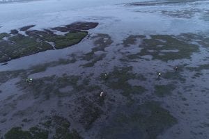
Drone view of the Pacific Northwest seagrass beds. (Credit: Citizen Science GIS)
Each research team from the affiliated universities was able to receive FAA certification after program participation and successfully completed their individual mapping of the field. Hawthorne points to the collaborative efforts across affiliated institutions for the success of the program.
“What is incredible is that regardless of everything, we were still able to make the fieldwork happen,” said Hawthorne. “If it weren’t for the collaboration and open mindedness across the institutions involved, it wouldn’t have been a possibility.”
The team’s latest paper led by Yang and Hawthorne summarizing the drone training program was recently published in Drones and can be accessed as a free, open access article at: https://www.mdpi.com/2504-446X/4/4/70.
Learn more about the work of Citizen Science GIS at UCF at www.citizensciencegis.org.