
Drone Research Hits New Heights
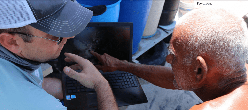
Hawthorne learning about island environments from a Belizean island resident examining Open Reef imagery.
As the popularity of drones and geospatial technologies continues to rise, the Citizen Science GIS research team at University of Central Florida aims to train the next generation of community-minded scientists in the art and science of drone flights, image processing, open data sharing and spatial storytelling with drone imagery.
The National Science Foundation has recognized the innovative efforts of Citizen Science GIS and their Open Reef Mapping Initiative with a new supplemental grant of $75,000 to expand their NSF Research Experiences for Undergraduates Site in Orlando and Belize.
Citizen Science GIS created Open Reef with the goal of changing the way science and society see and explore vulnerable island environments around the world through drone mapping, open data, storytelling,and citizen science. They use consumer-level drones to map vulnerable islands and coastlines (mainly in Belize and now in Florida) to identify the most vulnerable populations and to assist with disaster management and planning efforts.
“Our imagery replaces outdated, low resolution imagery found in developing countries like Belize. It allows us to see an incredibly high level of detail that opens up new mapping and analysis possibilities. Most importantly, we share our imagery for free with the public so that all can benefit from this resource in a manner that opens up science to broader society. All of our imagery is available for free on ArcGIS Online by searching for Open Reef,” said Timothy L. Hawthorne, Ph.D., assistant professor of GIS in the Department of Sociology and College of Sciences GIS Cluster.
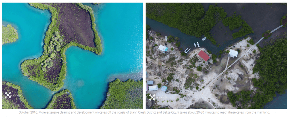
Open Reef drone imagery of Belize islands showing mangrove clearing and development challenges.
The new NSF funding is unique in that it allows Citizen Science GIS to train a nationwide pool of undergraduates to be the next generation of community-minded scientists in flying drones, processing imagery, sharing the imagery on open data sites and connecting these images with spatial stories from members of vulnerable communities.
“One of the main reasons we were funded, based on reviewer comments, is that our work isn’t just about drones and science. It’s about having our student researchers connect the stories of everyday individuals with the science to explore coastal vulnerability. There’s a real power in showing an island resident in Belize (or anywhere) an aerial drone image of his or her home and business and how they are impacted by the surrounding geography. So far we’ve heard stories of adaptation, destruction and survival as storms continue to batter the Caribbean on a yearly basis. We hope our imagery and these stories from communities can inform science and lead to better policies to protect the most vulnerable segments of society,” said Hawthorne.
Given the recent hurricanes and storms in Florida, Texas, Puerto Rico and the Caribbean, the Citizen Science GIS team is eager to expand its reach with new partners. To learn more about the work of Citizen Science GIS and their Open Reef initiative, please visit www.citizensciencegis.org. You can also attend Hawthorne’s upcoming presentation, Engaging Communities: Maps, Apps & Drones, at the College of Sciences Distinguished Speaker Series on October 11. RSVP and learn more.