Annual Belize Trip Trains Students, Assists International Community

Traveling to Hopkins Village, Belize, feels like a homecoming for Citizen Science GIS after six years of research and community work. Each summer brings a surprise, though.
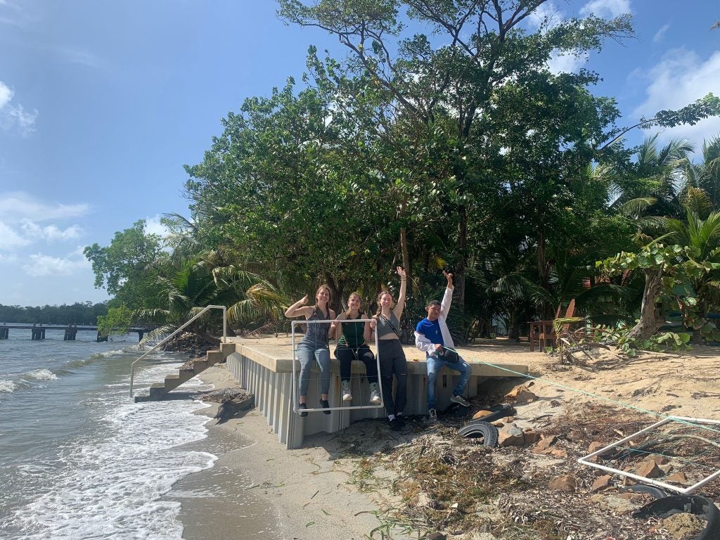
A new degree of urgency was injected into this year’s projects when Associate Professor Timothy Hawthorne, Ph.D., and the student team saw just how badly the beach had eroded in a year. A major focus of their work (funded by the U.S. National Science Foundation) is shoreline erosion and mapping beach debris and potential flood zones using drones and Geographic Information Systems (GIS) mapping.
“In all the years that I’ve been working in Hopkins… I’ve never seen the beach as eroded,” Hawthorne said. “There are a lot of concerns within the community.”
That revelation, and informal conversations with community members, set their agenda for the next seven weeks, while still leaving room for the other tasks on their list.
Citizen Science GIS connects communities and scientists by cultivating geospatial technology partnerships around the globe. This particular project is funded by an ongoing U.S. National Science Foundation Research Experiences for Undergraduates and Teachers (REU/RET) grant led by Hawthorne and Lain Graham, Ph.D., Affiliated Faculty at UCF and Senior Solutions Engineer at Esri. The project was founded in Hopkins Village, Belize by Hawthorne, his colleagues, and community partners. The “biggest motivator” in starting the program was to help students from all backgrounds, including lower-income backgrounds or with less scientific experience, participate in an immersive research experience and expand the work in Belize, explains Hawthorne.
“I think the most important thing and the thing I am most proud of is that we value working with communities,” Hawthorne said. “We don’t just parachute in as researchers and say we have all the answers to your problems; that’s not what we’re about.”
 Members of Citizen Science GIS have collected data for analysis of flood vulnerability and beach debris since the program was founded in 2016. The researchers work with community scientists using geospatial technology such as drone mapping to determine the percentage of sargassum in the beach. This allowed the community of the Hopkins Village and the researchers to clean up the sargassum found from the data collection and to identify future restoration priorities..
Valerie Melendez, a UCF undergraduate and member of the debris team, said that the program taught her how the community of Hopkins uses their resources to take care of their local ecosystems.
“The townspeople in Hopkins are incredibly knowledgeable about what is impacting their communities and the potential solutions,” Melendez said. “The Citizen Science GIS team would not have gotten as far as we did without that collaboration.”
Students fully immersed themselves in the community of Hopkins through interviews, field data and teaching the children about science, including how to fly mini drones.
Alexis Davis, a UCF undergraduate and member of the education team, said she originally had no prior knowledge or experience in GIS, but her team and faculty helped her to learn more about geographic technology and expanded her future career as an educator. Davis used the lessons from her internships at UCF to deploy different learning styles based on the children’s interests and ages.
As a prospective social studies teacher, Davis plans to use her newfound knowledge from her time in Belize to integrate science and GIS technology into her future classroom.
“The last recommendation I would give for someone interested in joining the education team is to just be yourself and open to the kids,” Davis said. “They are really appreciative and ready to learn, so putting your best self out there and showing your passion is super important.”
Although the time in Belize is completed for this year’s cohort of students, teachers and researchers, the work still has a long way to go, including future fieldwork experiences in Belize and another year of funding for a new student/teacher cohort in summer 2023. Further research within the Citizen Science GIS REU/RET Site will examine the increasing amount of debris that continues to be a major problem in the Village and other parts of Belize.
The students will share the data collected from the beach debris and flooding team to the community of Hopkins. This will allow other members to join in the future for follow up on the research conducted and reduce the debris washed up on the shore.
“The real research comes from the community knowledge and the fieldwork that we do,” Hawthorne said. “That’s why we prioritize training of community partners, including youth, because at the end of the day, they know what’s best for their community.”
To learn more about the Citizen Science NSF REU/RET Site, please visit: https://www.citizensciencegis.org/nsf-reuret-site
