
New Faculty Brings GIS Innovation to UCF
Starting this fall, Scott Branting, Ph.D., Timothy Hawthorne Ph.D. and Yingru Li, Ph.D. joined UCF’s GIS cluster. GIS stands for Geographical Information Systems or Geographic Information Science. It is a powerful information system that improves our ability to collect, store, retrieve, manage, analyze, and report information on the earth’s surface, and to integrate those with economic, social, environmental, and ecological information. Geographic Information Systems are the most prominent form of geospatial technology.
The Environmental Systems Research Institute (ESRI, 2014) defines GIS as an integration of “hardware, software, and data for capturing, managing, analyzing, and displaying all forms of geographically referenced information.” GIS is an incredibly powerful research method and framework for analyzing social and environmental inequalities, accessibility to social services and education, and other human behaviors.
GIS technology offers a gateway for students and the general public to delve more deeply into the most complex social and environmental issues of our time while understanding connections across multiple geographic scales.
Meet our new faculty:
 Dr. Li is an assistant professor in GIS at the department of sociology. Her research primarily focuses on Geographical Information Systems and spatial statistics, environmental health, and economic/urban geography. Currently, Dr. Li is examining the interactions between social and environmental injustices and children’s behaviors, psychosocial well beings, and weight status in southern rural areas.
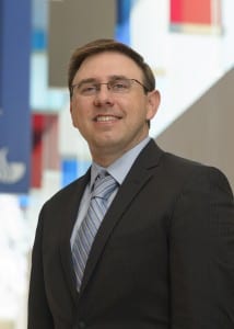 Dr. Hawthorne is also an assistant professor of GIS in the department of sociology. Dr. Hawthorne’s research and teaching utilizes innovative methods to integrate qualitative data and mixed methods into GIS analysis. He hopes to develop a new GIS certificate program at the graduate and undergraduate levels, as well as a Ph.D. program around interdisciplinary GIS applications. Within sociology, Hawthorne believes the new area of GIS will allow students to broaden their skill-sets and become more attractive for future careers in the academic and non-academic world.
 Assistant professor of anthropology, Scott Branting, currently is an active archaeologist who directs a field project at the site of Kerkenes Dağ in central Turkey. He leads an interdisciplinary and multi-institutional team that is in the progress of exploring and excavating an enormous ancient city. Dr. Branting is very interested in developing a satellite so we could take images and get feedback immediately.