
Open Reef Drones Take on Environmental Conservation
Geographic information systems (GIS), and related geospatial technologies like drones, are being used to do wonders for our planet. With the growing issue of climate change and over-development, University of Central Florida researchers have taken the initiative to protect the areas with the greatest risks: islands and coastal areas.
UCF Assistant Professor of GIS in the Department of Sociology Tim Hawthorne, Ph.D., is making a global impact with multiple GIS projects through Citizen Science GIS. Its mission is to work with communities across the globe to visualize local knowledge through GIS, drones and collaboration.
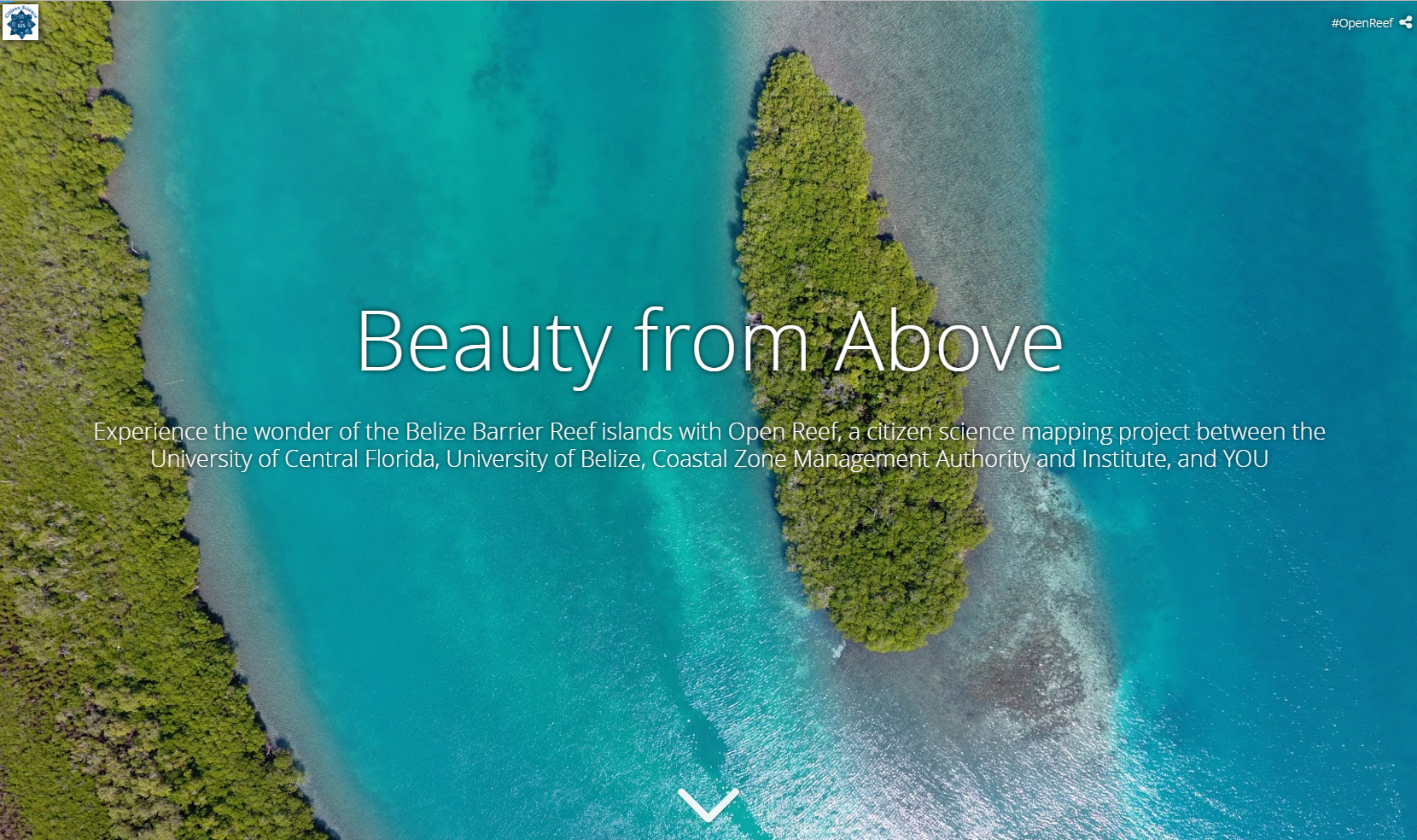
One project of the initiative is the Open Reef Mapping Society, a groundbreaking project that seeks to collect high-resolution aerial imagery of every island in Belize. To make this effort global, the data gathered by the society are shared online for free so that anyone around the world can participate and understand the impacts of climate change.
Click the image to experience the wonder of the Belize Barrier Reef Islands with Open Reef.
The UCF researchers spearheading this project teamed up with the University of Belize for a wider and innovative reach.
Hawthorne explained the collaboration with the University of Belize (UB) grew out of conversations as part of their work in Hopkins, Belize through their NSF Research Experiences for Undergraduates grant.
“We all agreed that UCF and UB could come together to use drones in a creative way to provide high resolution and updated imagery of all of the islands of Belize,” said Hawthorne. “The clarity we can offer through Open Reef, especially for smaller islands that are often not even visible through current imagery, is astounding for research and teaching purposes.”
GIS lecturer at the University of Belize Antonio Cano, M.Sc., MPA, expressed his excitement for the collaboration with UCF, the Coastal Zone Management Authority & Institute, and other partners as part of the Open Reef Mapping Society.
“The dynamic cross cutting international collaboration that guides the Open Reef Mapping Society is significant as it enhances the potential for capacity building, further research, and sound conservation efforts,” Cano said. “The initial imagery that has been collected through the ORMS is of extraordinary quality and is a substantial improvement over existing imagery. The subsequent use of this imagery is boundless.”
The imagery is used to create open geographic data that can provide researchers and citizen scientists with important information such as land use, shoreline boundaries, damages and human adaptation to climate change. These data can help to create sustainable development plans, assess storm damage and much more. The captured images also show how some of the Belizean islands are being destroyed by the effects of global warming and development.
Hawthorne and his team hope that the Open Reef project can advocate for environmental awareness and change through citizen science.
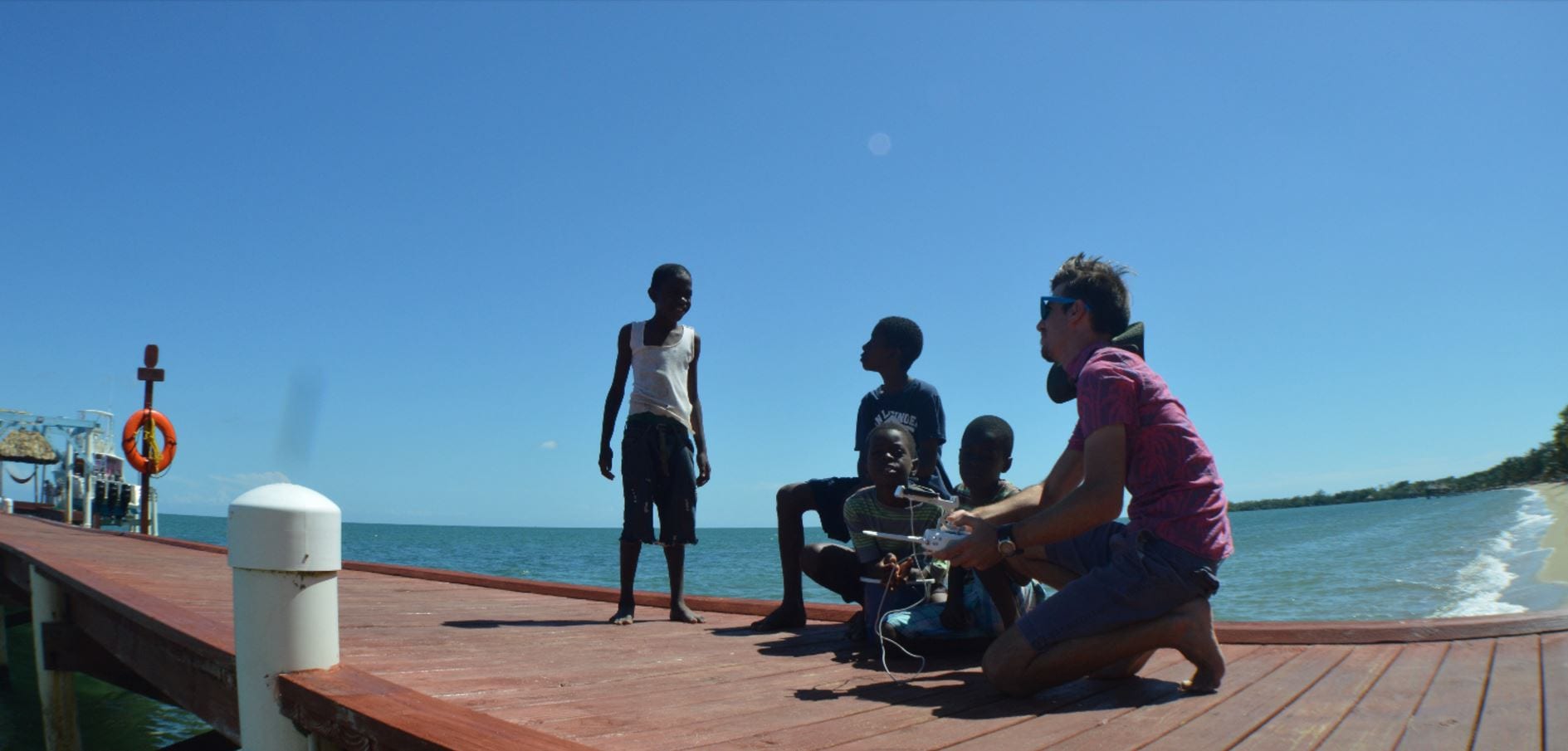
Nicholas Altizer discussing drones and GIS with Hopkins’ locals.
Sociology master’s student Nicholas Altizer, sociology doctoral student Lain Graham, and humanities and cultural studies sophomore Emily Clark make up the UCF team chosen to be involved in the project. Each member demonstrates a keen interest in using geospatial technology for good by exploring social and environmental issues, according to Hawthorne.
The Open Reef team plans to return to Belize in March to continue the ongoing project, mapping Turneffe Atoll. That trip will include an even larger international team from the University of Belize and a research colleague from Australia, Karen Joyce, Ph.D. Joyce will also give a public talk on UCF main campus at the UCF GIS Speaker Series on Thursday, March 23 from 3:15-5 p.m. in the multipurpose room of the Barbara Ying Center.
Hawthorne encourages students interested in getting involved to take one of the many GIS courses offered at the university. He said those students are the best equipped to head out into the field for this unique international research experience.
“And for students who can’t make it to Belize, we have several opportunities to participate in our research here on campus,” Hawthorne explained. “We now offer GIS certificate programs at the graduate and undergraduate levels to complement nearly any major on campus. These courses and research experiences teach technology skills that are in incredible demand in the government, non-profit, education, business and private sectors.”
Hawthorne and his colleagues are seeking to make a great impact through these projects. Currently, Citizen Science GIS is accepting donations through the Ignite Campaign to truly take off in their mission to fight environmental destruction. To learn more click here.