-
Researchers Receive $1.25 Million Grant to Map Marine Ecosystems With Drones
By Rachel Wimmer You may soon be able to spot UCF drones collecting data all along the Pacific coast — from Baja California to Alaska. Timothy Hawthorne, assistant professor of GIS in the Department of Sociology, and his collaborators at the Smithsonian Institution, Cornell University and the University of California-Davis recently received a $1.25 million grant […]
-
Citizen Science GIS Team Unites Community Using Drones
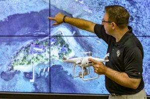
UCF’s Citizen Science GIS team has spent the last few years using drone technology to map the coastline and local island communities of Belize. Led by UCF’s assistant professor, Timothy L. Hawthorne, Ph.D., the Citizen Science GIS team aims to strengthen the connections between science and society through geographic information systems and drones. As an […]
-
Drone Research Hits New Heights
As the popularity of drones and geospatial technologies continues to rise, the Citizen Science GIS research team at University of Central Florida aims to train the next generation of community-minded scientists in the art and science of drone flights, image processing, open data sharing and spatial storytelling with drone imagery. The National Science Foundation has […]
-
Maps, Apps and Drones
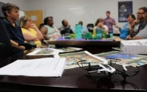
University of Central Florida professors of geographic information systems and biology teamed up Wednesday to take GIS technology and drones into Florida classrooms for 5th grade through high school. In the geospatial technology training workshop for Florida teachers, 15 teachers were shown customizable lesson plans that use GIS, mapping and drone technologies. Tim Hawthorne, GIS assistant […]
-
Open Reef Drones Take on Environmental Conservation
Geographic information systems (GIS), and related geospatial technologies like drones, are being used to do wonders for our planet. With the growing issue of climate change and over-development, University of Central Florida researchers have taken the initiative to protect the areas with the greatest risks: islands and coastal areas. UCF Assistant Professor of GIS in […]


