
UCF Team Secures Second Place in National Algorithms for Threat Detection Challenge
UCF researchers excel in anomaly detection to support national security research and advance real-world data science.
Written by: Emily Dougherty | Published: January 8, 2025
A team of UCF researchers and students recently earned a second-place finish in the National Algorithms for Threat Detection (ATD) 2025 Challenge, a national data science competition sponsored by the National Geospatial-Intelligence Agency (NGA) and hosted by Penn State’s Applied Research Lab in connection with the National Science Foundation (NSF)-NGA ATD research program. The contest pushes participants to develop advanced algorithmic solutions for large-scale, complex and often incomplete spatiotemporal datasets related to national security.
Each year, principal investigators (PIs) across the country receive the invitation to compete, with only a fraction of them deciding to take on this challenge due to the competition’s rigor. This year marked the fourth consecutive year Associate Professor of Statistics and Data Science Hsin-Hsiung “Bill” Huang served as PI and oversaw the project and his team’s participation.
“This is a nationwide data competition organized by the NSF. Every year they propose a challenging large-scale spatiotemporal dataset, and it invites all the PIs,” he says. “Once you join, you have only about two and a half months to build a model.”
Participants received anonymous vessel observations, known as posits, which include time, location, speed, and the additional inclusion of intentional sparsity with injected errors and noise in position and time. The teams were tasked to connect them to 24-hour vessel tracks in the Gulf Coast and Florida Straits.
“Some of the vessel locations weren’t in the water because of the artificial noise added,” Huang says. “That prevents anyone from simply relying on maps or historical data. Everything must be modeled from scratch.”
He explains that the datasets provided are intentionally difficult to work with. They contain long time series, vast spatial domains, and highly irregular or outlier-heavy data that make standard analytical tools ineffective. Many top universities have attempted the challenge but ultimately withdrew.
“The challenge is known for its rigor and steep computational demands,” he says. “Due to the scale and complexity, not all invited teams submit final solutions.”
Despite the formidable obstacles, Huang’s team excelled by combining statistical modeling, machine learning techniques, domain expertise, and interdisciplinary problem-solving.
Why Reconstructing Incomplete Ship Tracks Matters
Huang explains how this type of research directly supports national security by enabling analysts to detect and monitor potential threats even when identifying information is missing or intentionally withheld.
“Many commercial vessels broadcast Automatic Identification System (AIS), but illegal or high-risk vessels may disable, spoof, or avoid transmitting signals, creating gaps that reconstruction methods aim to address,” Huang says. “We need algorithms that can track them despite missing information.”
These methods extend beyond maritime contexts as he says they apply to aircraft, military operations in terrain that block GPS signals, and even emerging threats.
“Missing spatiotemporal data is a very important problem,” Huang says. “Whether it’s vessels, airplanes, or even balloons entering our territory, we need to reconstruct paths to identify and respond to potential threats.”
Teamwork as a Competitive Advantage
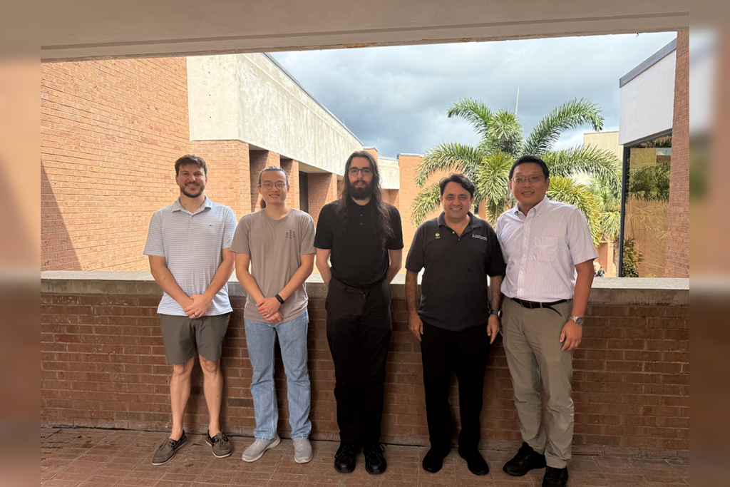
The team included Ph.D. students John “Mahlon” Scott and Yuh-Haur “Jackie” Chen along with Joshua White, who joined the team during the middle stage of the competition and contributed to the project’s development, and associate research scientist Bulent Soykan, whose expertise in simulation and modeling was critical.
“There is no single model that can solve the whole problem. We had to partition the U.S. waters into different structures—Tampa Bay, the Mississippi River, the ocean—and then stitch everything together because vessels move between them. That was the main challenge,” Soykan says.
Each member contributed unique domain knowledge and identified patterns in the data. Huang says his observations from real local environments even helped inform modeling decisions.
“One evening in Miami, I saw many small private boats moving through the harbor,” he says. “That made me realize how important time of day is in predicting patterns. Living in Florida helps—we can observe real vessel behavior and bring that insight back to the model.”
How Their Strategy Evolved
The team initially explored models from previous ATD challenges, but Scott explains they quickly realized the new dataset required a different approach.
“We started by trying a model from a previous challenge, but it was too restrictive for the size and density of this dataset, so we spent a lot of time searching for alternatives,” Scott says.
Eventually, the team shifted toward a different approach, incorporating decision techniques that evaluated multiple possible vessel connections and chose the most likely path. This allowed the model to adapt to varied environmental conditions and vessel behaviors.
“If you have ten possible vessels in the past and a new data point appears, you need a way to determine which one it belongs to,” Scott says. “That linking process was key.”
They combined specialized modeling approaches across different maritime environments and designed a scalable workflow to handle the dataset’s size and irregularity.
Connecting the Challenge to Real-World Research
Huang’s broader research focuses on anomaly detection and large-scale Bayesian modeling under the NSF ATD program. The annual competition serves as both a proving ground and a source of real-world insight.
“This program collaborates with the NGA,” he says. “We have to build useful algorithms that can detect anomalies in vessel behavior. For me, the challenge isn’t just about the competition—we learn lessons and gain insight about how models behave on real and messy datasets.”
This year, the team explored hybrid modeling approaches capable of adapting to drastically different environments, such as narrow rivers versus open ocean, while still producing cohesive trajectories across regions.
A Result Built on Innovation and Collaboration
The team’s second-place achievement highlights the depth of their technical innovation and the power of cross-disciplinary collaboration. Their work not only excelled in the competition but also advanced their ongoing research into complex anomaly detection and trajectory reconstruction, fields with significant implications for national security.
As Huang summarized, the ATD Challenge is more than an annual contest. It is an incubator for new methods, new ideas, and new ways of understanding vast and noisy real-world data, a technological space where UCF continues to stand out.